Menu
Life in GIS
Search

Life in GISLife in GIS

Menu
  • About
  • GIS
  • Remote Sensing
  • Geo-Stories
  • Downloads
  • GIS Terms & Definitions
  • QGIS Course
Search
close
Life in GISLife in GIS
close
  • About
  • GIS
  • Remote Sensing
  • Geo-Stories
  • Downloads
  • GIS Terms & Definitions
  • QGIS Course
Create a web map

Life in GIS is your go-to-site on GIS tutorials, Web-GIS Development, GIS Articles, Geo-Stories, Remote Sensing, UAVs, GIS Data, GIS Tutorials.The platform was established as an initiative to share knowledge within the GI sector in which tutorials, both text, and video, have been used for this purpose

Stay in the loop

Categories
  • Posted inin Geodatabase
  • GIS Programming

Most popular frameworks for back-end WebGIS Development

  • Posted byby Risper Mutinda
  • 0 Comments
  • 3 min
  • 3 min
    • Share
A lot goes on in the backend of a WebGIS application. In the backend, most of the manipulation...
  • Continue Reading
  • 3 min
Categories
  • Posted inin GIS
  • Tutorials

Importing vector and raster data in the GEE

  • Posted byby
  • 0 Comments
  • 1 min
  • 1 min
    • Share
Vector and raster data formats are used in the analysis in the Google Earth Engine. Vector data can...
  • Continue Reading
  • 1 min
Web-GIS-Development
Categories
  • Posted inin GeoInformation
  • GIS Programming

Most Popular Libraries for Front-end Web-GIS Development

  • Posted byby Risper Mutinda
  • 0 Comments
  • 2 min
  • 2 min
    • Share
The onset of the World Wide Web has revolutionized everything around us and GIS is not an exception....
  • Continue Reading
  • 2 min
Categories
  • Posted inin GIS
  • Tutorials

Plotting a Digital Elevation Model profile in GEE

  • Posted byby Risper Mutinda
  • 0 Comments
  • 2 min
  • 2 min
    • Share
A digital elevation model is a representation of the bare ground topographic surface of the earth exclusive of...
  • Continue Reading
  • 2 min
Categories
  • Posted inin Tutorials

Cloud masking on GEE using Landsat 8

  • Posted byby Risper Mutinda
  • 0 Comments
  • 2 min
  • 2 min
    • Share
Cloud masking on GEE using Landsat 8 involves the identification and removal of cloud-contaminated pixels from satellite imagery....
  • Continue Reading
  • 2 min
Categories
  • Posted inin GIS
  • Tutorials

Computing NDBI in Google Earth Engine

  • Posted byby Risper Mutinda
  • 1 Comment
  • 2 min
  • 2 min
    • Share
What is NDBI? Normalized Difference Built-up Index (NDBI) is a spectral index used to analyze built-up areas. This...
  • Continue Reading
  • 2 min
Categories
  • Posted inin GIS
  • Tutorials

Computing MNDWI using Sentinel on GEE

  • Posted byby Risper Mutinda
  • 1 Comment
  • 2 min
  • 2 min
    • Share
What is MNDWI? Modified Normalized Difference Water Index (MNDWI) is a spectral index used to analyze water bodies...
  • Continue Reading
  • 2 min
Categories
  • Posted inin GIS
  • Tutorials

Feature Joins in Google Earth Engine

  • Posted byby Risper Mutinda
  • 0 Comments
  • 2 min
  • 2 min
    • Share
Joins are used to combine elements from different collections (e.g. Image Collection or Feature Collection) based on a...
  • Continue Reading
  • 2 min
Categories
  • Posted inin GIS
  • Tutorials

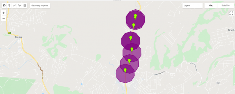
Computing buffers in Google Earth Engine.

  • Posted byby Risper Mutinda
  • 0 Comments
  • 1 min
  • 1 min
    • Share
Google Earth Engine supports a wide variety of geometric operations. These include operations on individual geometries such as...
  • Continue Reading
  • 1 min
Categories
  • Posted inin Tutorials

Preview image collection using time-series

  • Posted byby Risper Mutinda
  • 0 Comments
  • 1 min
  • 1 min
    • Share
This article focuses on how to prepare and preview image collection, provides example code for collection visualization method,...
  • Continue Reading
  • 1 min
Categories
  • Posted inin GIS
  • Tutorials

Pan-Sharpening on Landsat 8 image in GEE

  • Posted byby Risper Mutinda
  • 0 Comments
  • 1 min
  • 1 min
    • Share
Pan-sharpening is the process of enhancing a low-resolution multiband image by fusing it with a corresponding high spatial...
  • Continue Reading
  • 1 min
Categories
  • Posted inin GIS
  • Tutorials

Burn severity mapping using Imagery

  • Posted byby Risper Mutinda
  • 0 Comments
  • 4 min
  • 4 min
    • Share
Burn severity refers to the effects that fire intensity has on the functioning of an ecosystem in the...
  • Continue Reading
  • 4 min

Posts pagination

  • Newer Posts
  • 1
  • …
  • 7
  • 8
  • 9
  • 10
  • 11
  • …
  • 13
  • Older Posts

New QGIS Course

Editors Picks

Chosen by the editor

    • GIS
    Things to Learn Before Others in GIS (and Why they Matter)
    • Posted Wanjohi Kibui
    • August 29, 2025
    • GeoStories
    GIS Is Disappearing and Nobody’s Talking About It
    • Posted Wanjohi Kibui
    • July 8, 2025
    • GIS
    Why Building Geospatial Web Apps is a Game of Trade-offs
    • Posted Wanjohi Kibui
    • May 1, 2025
  1. Web GIS development
    • Geodatabase
    Ultimate Web GIS Development Roadmap
    • Posted Wanjohi Kibui
    • November 12, 2024

Follow Us

Join us

  • twitter
  • facebook
  • youtube

Trending

Popular Posts

    • Web GIS
    Best Mapping Library: Perfect Tool for Geospatial Success
    • Posted Wanjohi Kibui
    • August 8, 2024
  • geospatial software development analysis
    • GIS
    Geospatial Software Development Cheatsheet
    • Posted Wanjohi Kibui
    • June 11, 2024
  • geospatial company
    • GIS
    Why Geospatial Companies are Key to the Future of Data Strategies
    • Posted Wanjohi Kibui
    • May 29, 2024

Editors Choice

Top Picks

    • GIS
    Things to Learn Before Others in GIS (and Why they Matter)
    • Posted Wanjohi Kibui
    • August 29, 2025
    • GeoStories
    GIS Is Disappearing and Nobody’s Talking About It
    • Posted Wanjohi Kibui
    • July 8, 2025
    • GIS
    Why Building Geospatial Web Apps is a Game of Trade-offs
    • Posted Wanjohi Kibui
    • May 1, 2025

Popular

Popular Posts

  • Open-Source Web Maps
    • Postedby Wanjohi Kibui
    • 1 min
  • Geodjango Tutorials
    Adding data to ExtJS grid from PostgreSQL
    • Postedby Wanjohi Kibui
    • 2 min
  • Publishing maps using QGIS Cloud
    • Postedby Wanjohi Kibui
    • 2 min
2025 © Life in GIS