Vector and raster data formats are used in the analysis in the Google Earth Engine. Vector data can be in formats such as shapefile, which is the most commonly used, Digital Line Graph (DLG), Keyhole Markup Language (KML), GeoJSON (Geographic JavaScript Object Notation), among others. Raster data formats on the other hand can be in GeoTIFF, TIFF, GIF, JPEG, and PNG among others.
This blog will cover the importation of raster and vector data formats in the Google Earth Engine in the following steps:
- On the assets section of the Google Earth Engine code editor, click on the “new” icon.
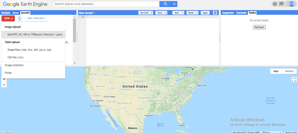
- There are representations for raster data on the image upload section and table upload for vector data. In this blog , vector data in form of a .zip file is being uploaded. A click on the image upload displays this:
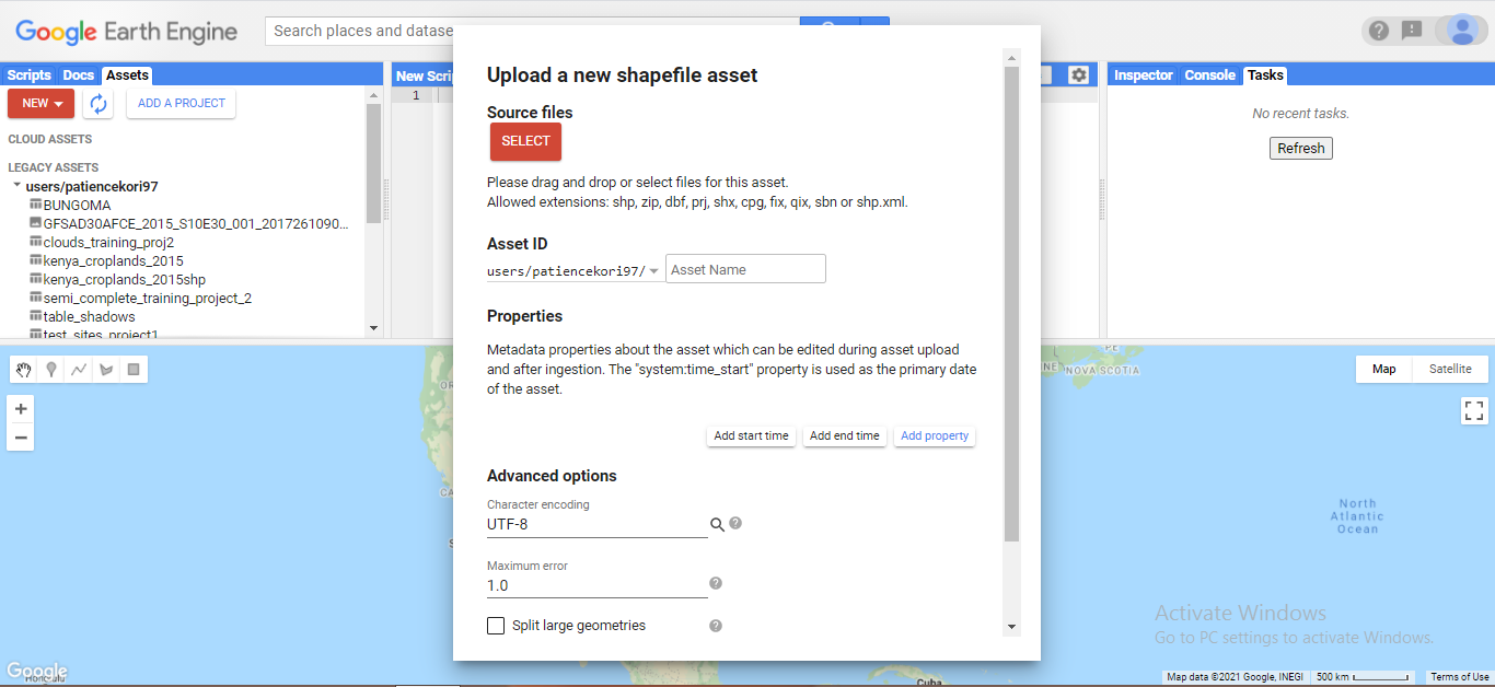
- The select button enables one to access the file in the folder saved in their computer. The specific vector formats that are supported in Google Earth Engine are indicated. In this case, a .zip file is selected.
- The remaining steps are left on default. The .zip file is uploaded using the upload button at the bottom right corner.
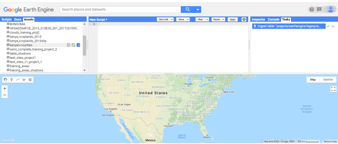
- Once the file starts uploading, the process is displayed on the tasks bar. Upon completion the file is available for use at the assets section of the editor as shown below:
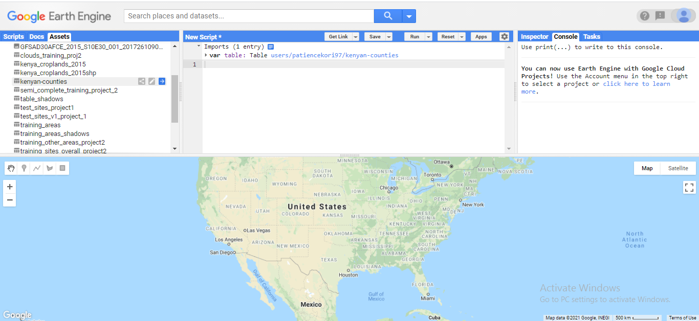
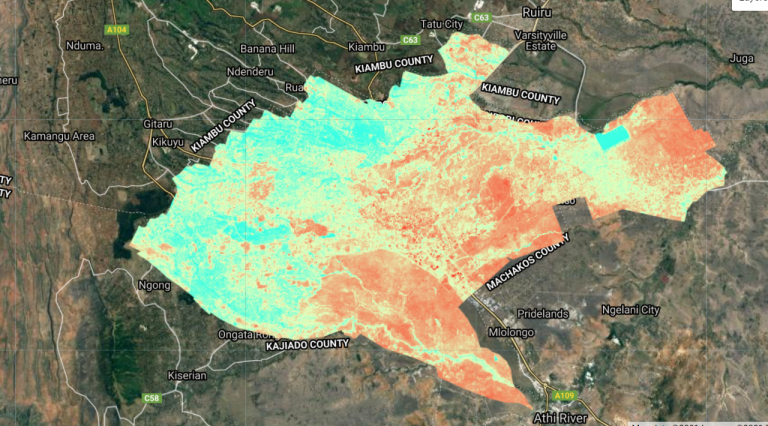
- Below is a representation of the imported file in the code editor.




Importing vector and raster data in the GEE