As GIS enthusiasts, we all know that it’s one of the most exciting times of the year, the GIS week. It has been running since the 15th of November 2021 reaching the climax today, the 17th of November 2021, which is the popular GIS Day. GIS day is a worldwide event that celebrates the applications and impacts of Geographic Information Systems (GIS) in the world. Ralph Nader inspired GIS Day as a day for geography awareness.
Most organizations in the world of Geospatial, Academic institutions, not forgetting Universities have all been excited about GIS awareness week. The excitement is seen through the many events taking place in these organizations and institutions of academia. This year’s GIS Day marks the 21st Anniversary, the first one being held on November 19, 1999, during Geography Awareness Week from November 14-20, 1999. Originally, it is the National Geographic Society, Association of American Geographers (AAG) and Esri, who really put the day into action on November 19, 1999.
Why GIS Day?
GIS Day was introduced with the purpose of raising awareness about GIS technologies and their applications. This has happened in most Kenyan Universities in that knowledge about different GIS technologies is shared. Moreover, Topics such as GIS, Remote Sensing, Drone Mapping, Web Mapping, GIS Development, GIS Applications, ESRI Story Maps, Geospatial Data Science and GeoAI among others are the subject of discussion during GIS week.
Geographic Information System: A computer-based system that enables the collection, processing, analysis, manipulation, visualization and storage of geographic data for the purposes of problem-solving and decision-making.
Remote Sensing: The science, art and technology of obtaining information about an object or phenomenon without coming into physical contact.
Drone Mapping: An aerial survey that enables the collection of high-resolution data conducted by a drone and specialist cameras, which can include RGB (for photogrammetry), multispectral, thermal or LiDAR sensors.
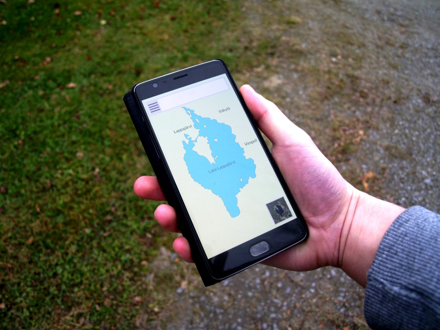
Web Mapping: The process of designing, implementing, generating, and delivering maps and availing them using the World Wide Web.
GIS Development: The process of designing, programming, deploying and maintenance of GIS software and GIS Applications.
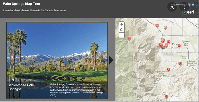
ESRI Story Maps: A platform by ESRI that enables one to create inspiring, immersive stories by combining text, interactive maps, and other multimedia content.
Geospatial Data Science: A discipline that focuses on the spatial component of data science. It brings forth theories, concepts and applications that are specific to geographic data in the realm of data science.
GeoAI and Machine Learning: The intersection of geospatial technology with Artificial Intelligence and location. It enables object detection and classification from both point clouds and raster surfaces derived from remotely sensed data.
Applications of GIS
Today, ESRI held Africa GIS Day virtually. From the event, the main application of GIS is monitoring the indicators of the planet.
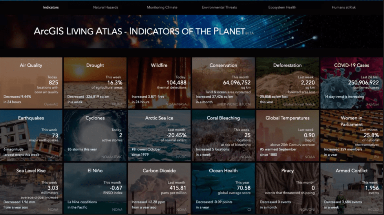
They include air quality, drought, wildfires, conservation, deforestation and COVID-19 cases. In addition to, earthquakes, ocean health, sea level rise, global temperatures and armed conflict. All these problems revolve around the Sustainable Development Goals (SDGs) can be solved using the aforementioned GIS technologies.
How and where did you celebrate GIS Day? Regardless of how you did it, do not forget that the most important thing during this day. To remember and recognize the idea of “where”. It has the power to solve almost all of the world’s problems, transforming this planet into a better place, which is what you and I want. Happy GIS Day!


GIS Week – Geospatial Awareness