After working 10+ years in the Geospatial sector, I can comfortably tell you this.
There is a simple truth about building a meaningful career in the GIS industry. It is something many professionals only realise much later in their journey.
Your career will grow in proportion to the problems you choose to solve.
- Not the tools you learn.
- Not the certificates you collect.
- Not the number of webinars you attend.
- And certainly not the number of posts you publish on online professional platforms such as LinkedIn.
What ultimately shapes your path in this field is problem-solving using Geospatial. The ability to identify real-world challenges and use spatial thinking to address them.
Over the years, many people in the GIS community have reached out with similar questions. They ask what side projects they should work on, whether they should learn GIS programming, if there is still space in the industry or whether GIS can grow into a full-time career or business. Others want to know which skills will remain valuable over the next decade.
These are all reasonable questions. But most of them start from the same assumption: that the key to growth lies in learning more tools.
In reality, the most important starting point is the problem itself.
Let me explain.
Why the GIS Industry Often Focuses Too Much on Tools
Spend enough time in the geospatial industry and you will notice that many discussions revolve around software and technologies. Conversations frequently focus on which tools to learn next, which programming language is best for spatial analysis or which visualization framework produces the most interactive maps.
Tools are important, of course. They allow us to implement ideas and transform spatial data into insights. But tools alone do not create value.
A visually appealing map does not necessarily solve a problem. A sophisticated spatial dashboard does not automatically improve decision-making. In many cases, professionals build technically impressive solutions that never influence real-world outcomes.
This is where geospatial problem-solving becomes the differentiator.
When spatial thinking is applied to real challenges in finance, infrastructure, agriculture, logistics, climate science or urban planning, the value of GIS becomes immediately clear. The goal is not simply to produce maps but to enable better decisions.
Why Does This Project Exist?
Before opening any GIS software or writing code, it is worth pausing to ask a simple but powerful question:
Why does this project exist?
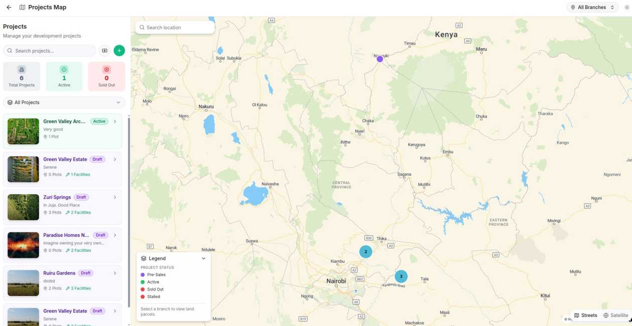
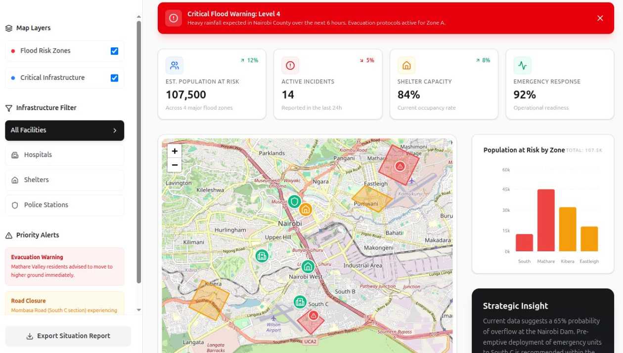
Many GIS side projects begin with curiosity or experimentation. Someone builds a map showing flooded areas in Nairobi, visualizes population density or creates an interactive dashboard displaying buildings and environmental data.
These projects are excellent learning exercises. However, they rarely translate into real-world impact.
Strong projects in geospatial problem-solving typically create measurable value. They help organizations do one or more of the following:
- Save money
- Reduce risk
- Increase revenue
- Improve compliance
- Make faster and more informed decisions
If your project contributes to any of these outcomes, it has the potential to move beyond a portfolio piece and become a valuable solution.
A Simple Example of Geospatial Problem Solving
Consider two different project ideas;
- The first project might map all the restaurants in a city. It may look visually impressive and demonstrate mapping skills.
- The second project might analyze spatial patterns to help fintech companies evaluate the risk of lending to small businesses based on location.
In the second case, spatial analysis could incorporate factors such as nearby economic activity, accessibility to major roads, proximity to competitors and historical business survival rates in the area.
Suddenly, the project becomes more than a map. It becomes a decision-support system that could influence financial lending decisions.
That is geospatial problem-solving in action.
The Importance of Thinking About Scale
Another important consideration when choosing projects is scalability.
Early in my GIS career, I worked on a project that seemed promising at first. The technology worked well, the spatial analysis was accurate and the system functioned as expected. However, as the project progressed, it became clear that the problem we were solving was too narrow.
It applied to a small group of users within a specific region. Expanding the system to other markets would require significant redesign.
That experience highlighted an important lesson: the best geospatial solutions are designed with scale in mind.
Scalability appears in two forms.
The first is technical scalability. Can the solution grow beyond a single organization? Could it eventually support multiple clients or integrate with enterprise systems? Could it evolve into a platform or API?
The second is market scalability. How widespread is the problem you are solving? If the issue exists across industries or across countries, the opportunity becomes much larger.
For example, mapping tourist attractions in a single town may be interesting but limited in scale. By contrast, building a geospatial system that helps logistics companies optimize last-mile delivery routes addresses a problem faced by businesses in cities around the world.
The difference between these two projects is not technology; it is scope.
Understanding Where the Real Market Is
One challenge many GIS professionals face is building solutions primarily for other GIS professionals. While these tools may receive appreciation within the GIS community, they rarely translate into sustainable business opportunities.
The real demand for geospatial problem-solving comes from industries that depend on spatial information to operate effectively.
These industries include:
- Governments managing urban development and infrastructure
- Banks evaluating financial and market risk
- Telecommunications companies planning network expansion
- Insurance companies assessing environmental risk
- Logistics firms optimizing delivery operations
- Energy companies planning infrastructure and resource distribution
These organizations already invest significant resources in understanding spatial patterns.
The key question therefore, becomes simple: Who already spends money trying to solve this problem?
If organizations are already investing in solving a particular challenge, there is likely an opportunity for better geospatial solutions.
A Real-World Scenario: Telecom Infrastructure Planning
Consider the challenge telecommunications companies face when expanding network coverage.
Determining where to place new towers requires analyzing multiple spatial factors: population distribution, terrain elevation, existing coverage gaps and projected demand.
A well-designed geospatial model that predicts optimal tower placement could significantly reduce infrastructure costs while improving service coverage.
In this scenario, spatial analysis is not simply visualizing data; it is guiding multi-million-dollar investment decisions.
That is the power of geospatial problem solving.
Thinking Long-Term: Where the Industry Is Heading
Another useful way to evaluate projects is to consider their long-term relevance.
Many of the most important technological trends today rely heavily on spatial data. Artificial Intelligence systems, digital twins, smart city platforms and climate monitoring tools all depend on location-based insights.
Fields such as climate risk analysis, supply chain optimization and infrastructure planning increasingly rely on geospatial data to guide decisions.
For example, governments and insurance companies are investing heavily in spatial models that assess risks related to floods, droughts, wildfires and rising sea levels. These systems help policymakers and financial institutions understand the long-term impacts of environmental change.
Projects aligned with these trends are likely to become more valuable over time.
Your Real Competitive Advantage in GIS
Many professionals assume their competitive advantage comes from mastering specific software or programming languages.
While technical skills are important, tools change quickly. Technologies that dominate today may become obsolete within a few years.
Your real advantage lies in something more durable: the ability to practice geospatial problem solving.
This means recognizing where spatial data can improve decisions, reduce uncertainty and create meaningful value. It means understanding the real challenges organizations face and designing spatial solutions that address those challenges at scale.
Professionals who think this way move beyond being tool users. They become problem solvers.
If you want to build a lasting career in GIS, start by changing the question you ask yourself.
Instead of asking, “What GIS tools should I learn next?”
Ask a more powerful question:
“What problems can geospatial help solve?”
Because in the end, your GIS career depends on the problems you choose.
In this regard, check out the course that helps you solve a real-world problem while learning to build enterprise web mapping solutions.


Your GIS Career Depends on the Problems You Choose