The world is full of data, hidden everywhere you look. From traffic jams to falling trees, there’s so much data representing events on our planet. This blog is about spatial data science tools that help us understand this data, tools that reveal the hidden stories of our world.
Think of it like this; imagine walking through a city at night. You see buildings, lights, and people, but the true energy happens behind the scenes, in the wires and pipes hidden beneath the streets. That’s where spatial data science comes in. These tools are like flashlights, shining into the data darkness and showing us the connections, patterns, and secrets hidden within.
What is spatial data science?
At its core, Spatial Data Science is the discipline that focuses on extracting meaningful insights and patterns from data that has a geographic or spatial component. It marries the principles of traditional data science with the unique challenges and opportunities presented by spatial information.
In simpler terms, it’s the art and science of understanding the “where” in data, transforming it into actionable knowledge.
Key Components of Spatial Data Science
- Geospatial Data – The foundation of Spatial Data Science lies in geospatial data—information tied to specific locations on Earth. This can include anything from GPS coordinates and satellite imagery to maps and spatial databases.
- Analytics and Modeling – Spatial data scientists utilize a range of analytical techniques and modeling approaches to uncover patterns and relationships within geospatial datasets. This can involve anything from spatial statistics to machine learning algorithms tailored for location-based insights.
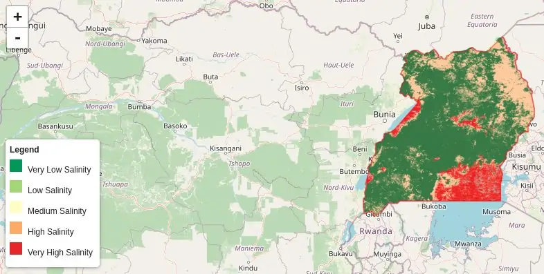
- Visualization – Visualization is a key aspect of Spatial Data Science, allowing practitioners to communicate complex spatial information in a more accessible manner. Maps, charts, and interactive dashboards are common tools in the spatial data scientist’s arsenal.
In the world of spatial data science, tools play a crucial role in decoding patterns and making smart decisions. Each tool is a superhero with its superpower. The integration of machine learning with tools like PyModis and sDNA has ushered in a new era of predictive analytics, allowing us to anticipate spatial trends and make informed decisions. The flexibility of open-source tools like RSGISLib and OWSLib ensures accessibility and adaptability in a rapidly evolving field.
Let’s dive in.
Analysis and Modeling Tools
- GeoPandas – GeoPandas seamlessly integrates spatial data handling capabilities with the data analysis prowess of Pandas. You can create, manipulate, and analyze geospatial data structures like geometric objects, topological relationships, and coordinate reference systems with ease.
- PySAL – PySAL is a comprehensive library for advanced spatial analysis. It helps in identifying spatial patterns, dependencies, and relationships within your data to uncover hidden insights.
- Scikit-learn – While not exclusively geospatial, Scikit-learn’s versatility extends to spatial analysis. Scikit-learn helps in building machine learning models for spatial prediction, classification, and clustering, incorporating spatial features for enhanced accuracy.
- PyVista – PyVista helps in creating interactive 3D visualizations of meshes, point clouds, and volumetric data, enabling immersive exploration and analysis.
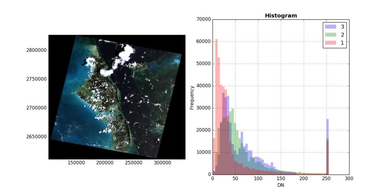
- Rasterio – Rasterio is a versatile library for reading, writing, and analyzing raster datasets. Helps to explore satellite imagery, elevation maps, and other raster-based geospatial data with ease.
- WhiteboxTools – This is a platform used to perform a wide range of spatial operations, analyses, and modeling tasks directly from the command line, empowering efficient workflows.
- PyMesh – PyMesh is used to create, modify, analyze, and repair 3D triangular meshes, empowering a wide range of applications in engineering, scientific visualization, and computer graphics.
- PyGeos – PyGeos is a Python binding to GEOS, a C++ library for spatial operations. You can use PyGeos to perform complex topological calculations, spatial predicates, and geometric transformations with ease
- PyKrige – PyKrige is a library dedicated to spatial interpolation and prediction using kriging methods. It can be used to generate accurate and robust spatial predictions while accounting for spatial autocorrelation and uncertainty.
- SpatialPandas – Used for spatial analysis capabilities within the familiar Pandas environment. It is used to work with geometric objects and spatial relationships directly within DataFrames, streamlining geospatial workflows

Visualization Tools
- Folium – Folium is used to create interactive Leaflet maps directly within Python, effortlessly blending data and maps for captivating visualizations.
- Plotly – Used for creating versatile and interactive geospatial plots spanning choropleths, scatter maps, and 3D globes, seamlessly integrated with other Plotly visualizations.
- Bokeh – Utilize Bokeh to construct interactive visualizations, exercising precise control over aesthetics and behaviour. This includes crafting maps, glyphs, and customized layouts for crafting visually compelling and tailored narratives.
- GeoViews – Employ GeoViews for delving into extensive geospatial datasets, enabling interactive maps and interconnected visualizations. Leverage HoloViews for dynamic exploration and visual analysis, enhancing your ability to interact with large-scale geographical data.
- Cartopy – Leverage Cartopy for the processing and analysis of geospatial data. This Python package is specifically crafted to simplify the creation of maps for data analysis and visualization, streamlining the process for seamless geospatial exploration
- Contextily – Used for seamlessly adding basemaps from various online tile providers (OpenStreetMap, Mapbox, Bing, etc.) to enrich your visualizations with real-world context.
- Ipyleaflet – Ipyleaflet is used for bringing interactive maps directly into Jupyter notebooks, fostering dynamic exploration and analysis within a familiar data science environment.
- Leafmap – Used for simplifying interactive mapping in Python with a user-friendly API built on ipyleaflet, enabling rapid creation of informative maps with minimal code.
- Mapbox GL JS – Used for harnessing the power of a high-performance web mapping library with Python bindings, unlocking dynamic and visually stunning map experiences.
- Kepler.gl – Well known for immersing yourself in web-based geospatial analysis and visualization, leveraging a Python API to create interactive maps, explore spatial patterns, and unlock insights from large datasets.
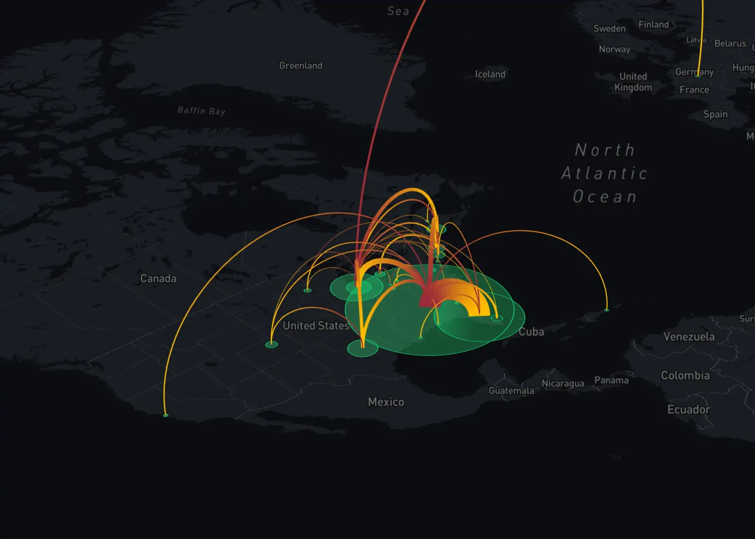
- deck.gl – Deck.gl is used for Creating 3D geospatial visualizations like scatter plots, heatmaps, and lines for stunning visual effects and layered data exploration. Think dynamic globes, animated flyovers, and interactive layers for immersive understanding.
- geemap – Lastly, geemap is used for Integrating Google Earth Engine directly into your Python workflow, unlocking access to massive Earth observation datasets and powerful cloud-based geospatial analysis tools. Imagine processing satellite imagery, analyzing deforestation patterns, and visualizing global climate trends – all within your Python scripts.
Network Analysis Tools
- NetworkX – NetworkX is a Python library specializing in the creation, analysis, and visualization of complex networks. Ideal for spatial data scientists, it empowers users to uncover intricate patterns and relationships within spatial datasets, making it a go-to tool for network analysis.
- OSMnx – OSMnx is a dedicated Python library designed for street network analysis using OpenStreetMap data. It plays a pivotal role in urban planning and transportation studies, providing valuable insights into the complexities of transportation networks and city landscapes.
- Pandana – Pandana stands out as a high-performance Python library tailored for network analysis in spatial data science. Widely used for efficient and scalable spatial analytics, Pandana ensures precision and speed in unraveling patterns and relationships within spatial datasets.
- GeoNetworkX – GeoNetworkX is a set of spatial extensions for NetworkX, enhancing its capabilities for geographic intelligence in network analysis. This combination allows spatial data scientists to elevate their analyses, providing an extra layer of geographic insight to network studies.
- sDNA (Spatial Network Analysis Toolkit) – sDNA, the Spatial Network Analysis Toolkit, is a comprehensive Python toolkit designed for dissecting and analyzing spatial networks. With applications in urban planning and transportation, sDNA empowers spatial data scientists to derive meaningful insights from complex spatial networks.
- graph-tool – graph-tool is a versatile and large-scale Python library for network analysis, offering efficiency and precision in handling complex spatial networks. It enables spatial data scientists to tackle intricate analyses, making it a valuable tool for large-scale network exploration.
- igraph – igraph is a Python library with bindings for network analysis, providing seamless integration for spatial data scientists. It enables the exploration of hidden patterns in spatial data, transforming raw information into strategic insights for various spatial analytics projects.
- Networkit – Networkit is a high-performance Python library specifically crafted for network analysis in spatial data science. Known for its efficiency in handling large-scale network datasets, Networkit amplifies the analytical capabilities of spatial data scientists, facilitating optimal efficiency.
- SNAP (Stanford Network Analysis Platform) – SNAP, the Stanford Network Analysis Platform with Python bindings, is a powerful tool for network analysis and visualization. Bridging Stanford’s cutting-edge capabilities with Python, SNAP empowers spatial data scientists to explore and analyze intricate spatial networks.
Earth Observation Tools
- Rasterio – Rasterio is a powerful Python library for reading and writing geospatial raster data. Essential for spatial data scientists, it facilitates efficient manipulation and analysis of raster datasets, making it a cornerstone for geospatial workflows.
- xarray – xarray is a versatile Python library designed for labeled multidimensional arrays. Widely used in the geospatial domain, it provides an efficient and intuitive approach to handling complex spatial datasets, making it a go-to tool for data analysis and visualization.
- RSGISLib – RSGISLib, a Remote Sensing and GIS Library, is a comprehensive Python library for remote sensing applications. Tailored for spatial data scientists, it enables advanced analysis and processing of remote sensing data, making it an indispensable tool in the geospatial toolkit.
- eo-learn – eo-learn is a Python library designed for Earth observation data processing and analysis. With a focus on modular and scalable workflows, it empowers spatial data scientists to seamlessly integrate and analyze large-scale Earth observation datasets for informed decision-making.
- Dask-GeoPandas – Dask-GeoPandas is a specialized library for parallel spatial data processing using Dask. It enhances the efficiency of geospatial workflows, allowing spatial data scientists to scale their analyses for large datasets while leveraging the parallel computing capabilities of Dask.
- Satpy – Satpy is a Python library dedicated to reading and processing satellite data. An essential tool for Earth observation, it simplifies the handling of satellite datasets, making it easier for spatial data scientists to derive insights from diverse satellite imagery.
- PyModis – PyModis is a Python library for accessing and processing MODIS (Moderate Resolution Imaging Spectroradiometer) data. Ideal for spatial data scientists working with Earth observation, PyModis streamlines the retrieval and analysis of MODIS datasets.
- Seaborn-Geo – Seaborn-Geo is an extension of Seaborn, a popular data visualization library, designed to include geospatial visualizations. Spatial data scientists benefit from enhanced plotting capabilities, making it easier to create informative and visually appealing geospatial visualizations.
- OWSLib – OWSLib, or OGC Web Service Library, is a Python library for accessing geospatial web services. Essential for spatial data scientists, it facilitates communication with various web services, enabling seamless integration of geospatial data into analytical workflows.
- PyGeoapi – PyGeoapi is a Python implementation of the OGC API – Features standard. Tailored for spatial data scientists, it provides a standardized approach for accessing and managing geospatial features, fostering interoperability and facilitating the integration of geospatial data into diverse applications.
Geocoding Tools
- Geopy – Geopy, a versatile Python library, stands as a powerful geocoding tool for spatial data scientists. It facilitates seamless location-based data analysis by offering geocoding, reverse geocoding, and distance calculations, making it an essential component in the geospatial toolkit.
- Reverse Geocoder – Reverse Geocoder simplifies converting coordinates into human-readable location information. Ideal for spatial data scientists, this Python library enhances location-based data analysis by providing detailed location insights based on geographic coordinates.
- Libpostal – Libpostal, an open-source address parsing library, streamlines the parsing of addresses into structured data. Spatial data scientists benefit from its efficient address normalization capabilities, enhancing the accuracy of geocoding and address-based analyses.
- OpenCage Geocoder – OpenCage Geocoder is a robust geocoding solution designed for spatial data scientists. Leveraging a vast global database, it provides accurate and comprehensive location information, making it a reliable tool for geocoding and reverse geocoding applications.
- Nominatim – Nominatim, an open-source geocoder based on OpenStreetMap data, empowers spatial data scientists with a powerful tool for geocoding and reverse geocoding. Its integration with OpenStreetMap ensures access to a rich and up-to-date geographic database.
- Here Geocoder – Here Geocoder, a geocoding service by HERE Technologies, offers precise and efficient location-based data processing. Spatial data scientists benefit from its comprehensive geocoding capabilities, ensuring accurate and reliable location information for analysis.
- Google Maps Geocoding API – The Google Maps Geocoding API, with its Python client library, is a cornerstone for geocoding solutions. Spatial data scientists can seamlessly integrate Google’s vast mapping and geocoding capabilities, facilitating accurate location-based data analysis.
- ArcGIS Geocoding Service – The ArcGIS Geocoding Service, coupled with a Python client library, is a robust solution for spatial data scientists. Leveraging Esri’s geospatial expertise, it provides accurate geocoding and location-based analysis capabilities for diverse applications.
- OpenRouteService – OpenRouteService, an open-source platform for routing and geocoding, enriches the spatial data science toolkit. With a focus on accessibility and flexibility, it provides spatial data scientists with powerful geocoding and routing solutions for diverse applications.
- Geocodio – Geocodio, a commercial geocoding API, stands as a comprehensive tool for spatial data scientists. Offering accuracy and efficiency, it facilitates precise geocoding and address parsing, ensuring reliable location-based insights for diverse analytical needs.
Other Geospatial Toolkits
- Fiona – Fiona is a Python library for reading and writing geospatial data formats. Fiona is often used in conjunction with Geopandas for efficient data I/O operations.
- Pyproj – Pyproj is a library for performing cartographic projections and coordinate transformations. It is commonly used in geospatial workflows to ensure accurate representation of spatial data.
- Shapely – Shapely is a library for the manipulation and analysis of geometric objects, such as points, lines, and polygons.
- GDAL (Geospatial Data Abstraction Library) – GDAL is a powerful library for reading and writing raster and vector geospatial data formats. It provides a set of tools for data transformation and manipulation.
- H3-py – H3-py is a Python binding for H3, a spatial indexing system that represents the Earth’s surface as a hexagonal grid. It is useful for hexagon-based spatial data representation.
As we wrap up our in-depth journey into spatial data science tools, a vibrant landscape of geospatial analysis unfolds. These handy tools work together, helping us understand complicated connections and patterns in geographical information. They give data scientists the ability to study the different aspects of their data with accuracy and insight.
In conclusion, the blend of technology, geography, and data insights is always growing, promising a future where understanding the world through data becomes not just a story but an ongoing exploration.


A Deep Dive into Spatial Data Science Tools