In an era characterized by technological prowess, the domain of GIS has undergone a transformative evolution. This has ushered in what is now widely recognized as Modern GIS. These technological advances shape the contemporary state of GIS, introducing real-time data processing and sophisticated mapping software.
One of the hallmarks of Modern GIS is its seamless integration of diverse spatial data, breaking down data silos. This integration extends beyond theoretical concepts, providing actionable insights for urban planning and various industries. The paradigm shift towards Web GIS marks a turning point, extending global accessibility and collaborative potential.
What is modern GIS?
Modern GIS represent a sophisticated and dynamic evolution from traditional mapping and spatial analysis methods. In the contemporary context, Modern GIS involves utilizing geospatial data for insights. It integrates advanced technologies, such as cloud computing, real-time data processing, and web-based platforms, to provide a comprehensive and interactive approach to geospatial data management and analysis.
This evolution goes beyond static maps, incorporating three-dimensional visualization, mobile applications, and seamless integration with other technologies like machine learning and artificial intelligence.

What are the Core Principles of Modern GIS?
The principles encompassed within Modern GIS extend beyond mere mapping, incorporating web-based platforms, cloud computing, and advanced analytical techniques. In this blog, we unravel the layers of innovation that characterize Modern GIS.
- Spatial Data Integration
- Modern GIS emphasizes the integration of various types of spatial data from different sources. This includes satellite imagery, GPS data, demographic data, and more. Integrating diverse datasets allows for a comprehensive understanding of geographic phenomena.
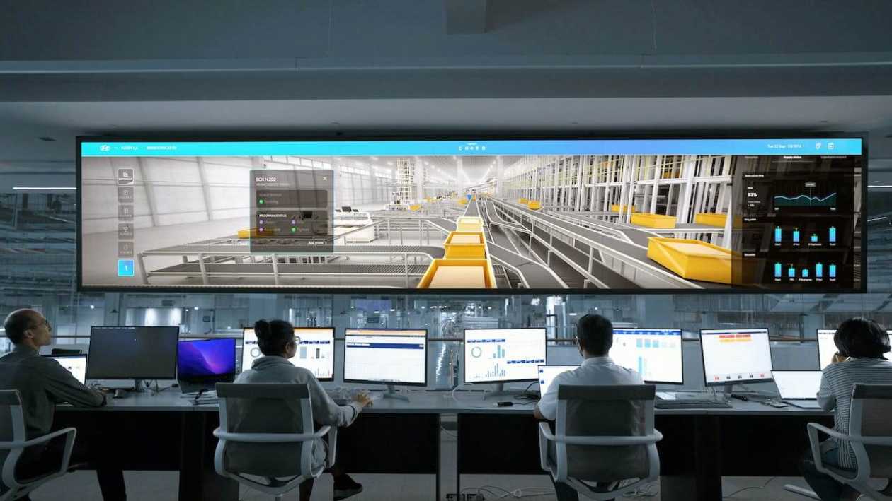
- Web GIS
- The integration of GIS with the web has become a fundamental aspect. Web GIS allows users to access, analyze, and share geographic information through web browsers, fostering collaboration and making spatial data more accessible.
- Cloud-Based GIS
- Cloud computing has transformed GIS by enabling the storage, processing, and analysis of large spatial datasets in the cloud. This facilitates scalability, collaboration, and access to GIS tools and data from anywhere with an internet connection.
- Mobile GIS
- Mobile technologies, including smartphones and tablets, play a crucial role in modern GIS. Field data collection, GPS tracking, and real-time updates have become standard features, allowing for dynamic data collection and analysis in the field.
- Spatial Analysis
- Modern GIS emphasizes advanced spatial analysis techniques. This includes geostatistics, network analysis, spatial modeling, and other methods that go beyond basic mapping. These techniques help uncover patterns, relationships, and trends within spatial data.
- Open Data and Open Standards
- Open data initiatives promote the sharing of geospatial information openly, leading to increased collaboration and innovation. Open standards ensure interoperability between different GIS platforms and data sources.
- 3D GIS
- The integration of three-dimensional data and visualization techniques is a key aspect of modern GIS. This is particularly important for urban planning, environmental modeling, and infrastructure management.
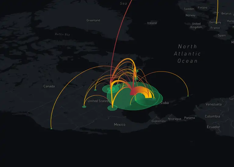
- Real-Time GIS
- Many applications now require real-time data, and modern GIS can handle and analyze data as it is collected. This is especially relevant for tracking moving objects, monitoring dynamic events, and emergency response.
- Data Quality and Accuracy:
- With the increasing volume of spatial data, maintaining data quality and accuracy is crucial. Modern GIS systems include tools for data validation, cleaning, and ensuring the accuracy of spatial information.
- User-Friendly Interfaces
- User interfaces have become more intuitive and user-friendly. This allows a broader audience, including those without a deep GIS background, to access and utilize GIS tools for decision-making.
- Machine Learning and AI Integration
- Modern GIS often incorporates machine learning and artificial intelligence techniques for automated analysis, feature recognition, and pattern detection within spatial datasets.
- Customization and Interoperability
- GIS platforms are designed to be customizable and interoperable with other software systems. This flexibility allows users to integrate GIS into their workflows and combine geospatial data with other types of information.
Impact of Modern GIS Principles
In the dynamic realm of geospatial technology, the adoption of Modern GIS principles has revolutionized the landscape, unlocking new dimensions of insight and efficiency.
- Bridging Knowledge Gaps
- Modern GIS principles prioritize seamless spatial data integration, eliminating silos and enabling a comprehensive understanding of geographic phenomena. This integration empowers businesses, governments, and researchers to bridge knowledge gaps, fostering data-driven decision-making. Organizations can now harness the power of diverse datasets, unlocking a richer understanding of spatial relationships and driving innovation across sectors.
- Global Accessibility and Collaboration
- Incorporating Web GIS principles has transcended traditional boundaries, providing global accessibility to geospatial information. Businesses can now collaborate seamlessly across distances, share real-time data, and engage with interactive maps. This not only enhances efficiency but also democratizes access to critical information, promoting a more inclusive approach to spatial analysis and planning.
- Scalability and Resource Optimization
- Modern GIS embraces cloud-based principles, offering scalable solutions for storing, processing and analyzing vast amounts of spatial data. This scalability not only optimizes resource utilization but also enables organizations to adapt swiftly to evolving data demands. Cloud-based GIS empowers users to leverage advanced computing capabilities without traditional infrastructure constraints, fostering agility and innovation.
- Empowering Field Operations
- The principles of Mobile GIS have redefined field operations by providing on-the-go access to geospatial tools. Fieldworkers can now collect and analyze data in real time, improving decision-making and response times. From environmental monitoring to disaster response, Mobile GIS principles enhance the accuracy and immediacy of spatial data, optimizing workflows and minimizing downtime.
- Unveiling Hidden Patterns
- The adoption of advanced spatial analysis principles in Modern GIS goes beyond mapping, and unveiling hidden patterns, relationships, and trends within spatial data. Businesses can extract actionable insights, researchers can conduct in-depth studies, and urban planners can make informed decisions. This heightened analytical capability is a game-changer, offering a competitive edge in an increasingly data-driven world.
- Fostering Collaboration and Innovation
- Modern GIS principles embrace open data initiatives, fostering collaboration and innovation. By openly sharing geospatial information, organizations contribute to a richer, more interconnected ecosystem. This approach not only enhances collective knowledge but also stimulates innovation, enabling the development of new applications, solutions, and approaches to addressing complex challenges.
Future Trends in GIS
Modern GIS has revolutionized how we understand and interact with the world around us, seamlessly weaving data into actionable insights across diverse fields. But the future of GIS promises even more breathtaking views, as cutting-edge technologies and innovative trends push the boundaries of spatial intelligence. Let’s embark on a journey into the future, exploring several emerging trends that will redefine the landscape of GIS.
- The Internet of Things (IoT) Explosion – Imagine billions of sensors embedded in the fabric of our cities, monitoring everything from air quality to traffic flow to soil moisture. The integration of IoT data with GIS will unleash a wave of real-time intelligence, enabling hyper-accurate monitoring, dynamic responses to change, and predictive modeling on a never-before-seen scale.
- Immersive 3D Experiences – A move beyond flat maps and step into a living, breathing 3D world. Advancements in 3D modeling and virtual reality will transform GIS into an immersive experience, allowing us to visualize and interact with spatial data in unprecedented ways. Imagine walking through a virtual replica of a city to analyze potential flood risks or exploring a proposed infrastructure project before it’s even built.
- From Maps to Digital Twins – GIS will evolve from creating map representations to crafting comprehensive digital twins of our world. These digital twins will incorporate real-time data, historical information, and predictive models, creating virtual replicas that mirror the behaviour and dynamics of their real-world counterparts. Imagine using digital twins to optimize energy grids, manage traffic flow in real time, and even predict the spread of wildfires.
- Democratization and Citizen Science – Access to and expertise in GIS will continue to break down barriers, empowering citizen scientists and local communities to contribute to data collection, analysis, and decision-making. User-friendly tools and intuitive interfaces will make GIS accessible to anyone with a smartphone, fostering a collaborative approach to understanding and managing our environment.
- Ethical Considerations and Responsible Use – With great power comes great responsibility. As GIS integrates with AI and IoT, concerns around data privacy, bias, and security will become paramount. Ethical frameworks and responsible data governance practices will be crucial to ensure equitable access, prevent misuse, and maintain trust in this powerful technology.
As organizations continue to embrace and adapt to these principles, the transformative potential of Modern GIS remains a driving force in the evolution of geospatial technology


Unveiling the Core Principles of Modern GIS