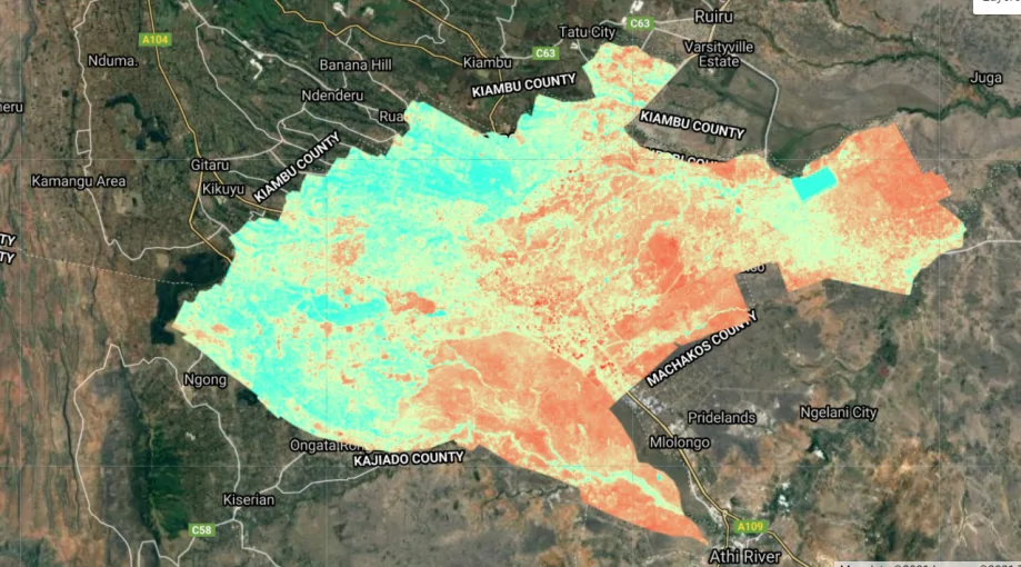
Computing NDBI in Google Earth Engine

What is NDBI? Normalized Difference Built-up Index (NDBI) is a spectral index used to analyze built-up areas. This...

Shapefile conditionals in GeoPandas & Numpy

While most shapefiles acquired from various sources are fairly ready to use with little or no edits, other...
Visualization Parameters in Google Earth Engine Explorer

Visualization Parameters in GEE Explorer

Visualization parameters enable a user to have a better view of the dataset. On the layers panel of the...
GIS Approach

A GIS and Remote Sensing Appproach: Food Security

A bare land lies at the foot of an unnamed hill—the locals are unconcerned with such trivial matters....
gis career

How to Grow Your GIS Development Career

At the start of your GIS development career, you will do a lot of research. Whichever the source, format or mode of the materials you use, you end up being a library by yourself.

9 Essential GIS Skills

We like maps and will continue to like them more. Every day, there are changes in the libraries used for mapping. With most maps being 2D, exploring 3D maps is so much fun and better

Using Free GPS Tools for Mapping

Sometimes we find ourselves lost while traveling. Right? But have you really tried to leverage some of the...
geospatial web application

Build an Enterprise Geospatial Web Application With Django, GeoDjango & Leaflet

Today, geospatial technology is no longer optional. It powers logistics platforms, land management systems, climate dashboards, utility planning,...

Install QGIS 3.4 in Ubuntu 16.04

The month of October, 2018, ushered in the new LTR, QGIS 3.4 “Madeira”. This was a long-awaited version...
gis-project

GIS Project Ideas For Every Developer

Embarking on GIS projects offers users or college students a dynamic avenue to apply theoretical knowledge and hone practical skills. It not only allows you to apply your geospatial expertise but also contributes to solving real-world challenges.

Latest Posts

See latest posts