Today, geospatial technology is no longer optional. It powers logistics platforms, land management systems, climate dashboards, utility planning, mobility apps, real-estate platforms and anything that depends on location. Yet, despite the growing demand, many developers and GIS practitioners struggle to transition from desktop GIS tools to full-scale geospatial web applications.
That’s why I’m excited to announce the launch of my new, in-depth course:
LandLoom: Build an Enterprise Geospatial Web Application Using Django, GeoDjango & Leaflet.js
This course walks you step-by-step through building a real, production-ready geospatial system; the same kind of system used by governments, enterprises, and tech startups globally.
Why Geospatial Web Development Matters Today
Organizations increasingly need solutions that go beyond static maps. They want systems that can:
- Display real-time data
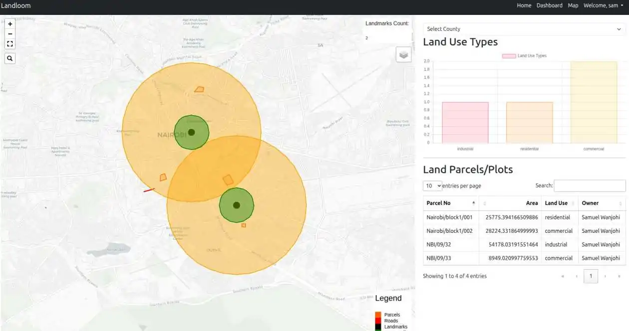
- Manage land parcels and ownership
- Provide dashboards for analysis
- Support user roles and permissions
- Handle uploads, spatial queries, and field data
- Integrate seamlessly with APIs and mobile apps
Unfortunately, there is still a massive skills gap between GIS knowledge and web development expertise. LandLoom bridges that gap.
Instead of just theory, you’ll build an end-to-end enterprise system with:
- A spatial database (PostGIS)
- A backend engine (Django & GeoDjango)
- A modern mapping frontend (Leaflet.js)
- A geospatial API list
- Authentication, RBAC, forms, media uploads & dashboards
- A clean, scalable architecture you can reuse in real projects
This is not a toy example. It’s a real system.
What You’ll Build in LandLoom
LandLoom is more than a collection of tutorials. It’s a complete geospatial platform with:
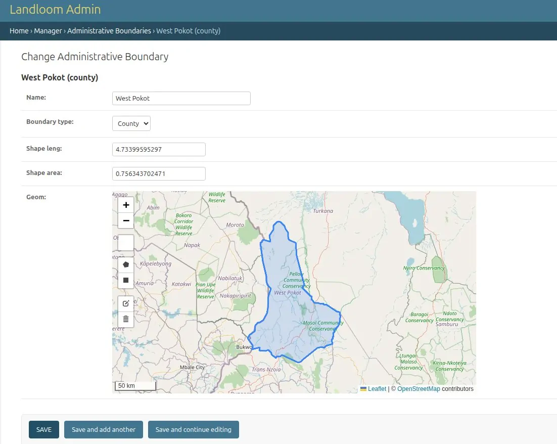
- Spatial models (parcels, zones, boundaries, points of interest)
- APIs for spatial data
- Interactive Leaflet maps
- GeoJSON layers with styling for points, lines & polygons
- User accounts, roles & permissions
- A Bootstrap-powered interface
- Record management interfaces
- Media uploads & attachments
- Map-linked tables, filters & popups
- Spatial operations (queries, highlights, buffers)
- Deployment-ready code
You aren’t just following along, you’re learning the architecture behind real geospatial systems.
What You Will Learn
This course is designed to make you productive, modern and capable of building high-level geospatial solutions. You will learn to:
- Build robust geospatial backends using Django & GeoDjango
- Perform advanced spatial analysis using PostGIS
- Create interactive maps with Leaflet.js
- Build secure systems with authentication & RBAC
- Work with GeoJSON, shapefiles, spatial queries & projections
- Connect APIs to frontend templates
- Add charts, tables, dashboards & map-data linking
- Implement geoprocessing like buffers
- Handle file uploads and media fields
- Use Git and environment variables for production
- Organize your project using clean, enterprise architecture
If you’ve been wanting to elevate your GIS + web development skills to enterprise level, this course will give you everything you need.
Who This Course Is For
This course is ideal for:
- GIS analysts who want to build full web platforms
- Web developers who want to add geospatial capabilities
- Students or professionals who want to transition into geospatial careers
- Companies building location-based apps
- Freelancers looking to deliver more advanced mapping solutions
Whether you’re in logistics, land administration, conservation, utilities, mobility, or monitoring & evaluation, this course gives you the foundation to build real systems.
Whether you want to:
- build your own geospatial platform
- level up professionally
- work on enterprise land management systems
- or simply understand how web mapping works end-to-end
LandLoom will give you the roadmap and tools to get there.
👉 Enroll now and start building your enterprise geospatial application.
Your next step in GIS + software is right here.

Build an Enterprise Geospatial Web Application With Django, GeoDjango & Leaflet